14 Property Red Flags Buyers Discover Too Late — And That Drone Photography Would Have Revealed

Updated: Jun 13
Every real estate listing tells a story. But most ground-level listing photos are telling an edited version of it.
A front elevation shot communicates curb appeal. An interior walkthrough communicates room size. A backyard photo communicates outdoor space. What none of those shots communicate — and what buyers consistently discover only after they've closed — are the environmental, infrastructural, and contextual conditions that surround a property.
High-voltage power lines that run 150 feet from the bedroom window. A flood-prone low area in the back third of the lot. A commercial truck-staging yard just beyond the fence line. A cell tower visible from the master suite. These aren't rare anomalies. They appear in listing after listing, and they stay hidden inside photo sets that shoot inward, not outward.
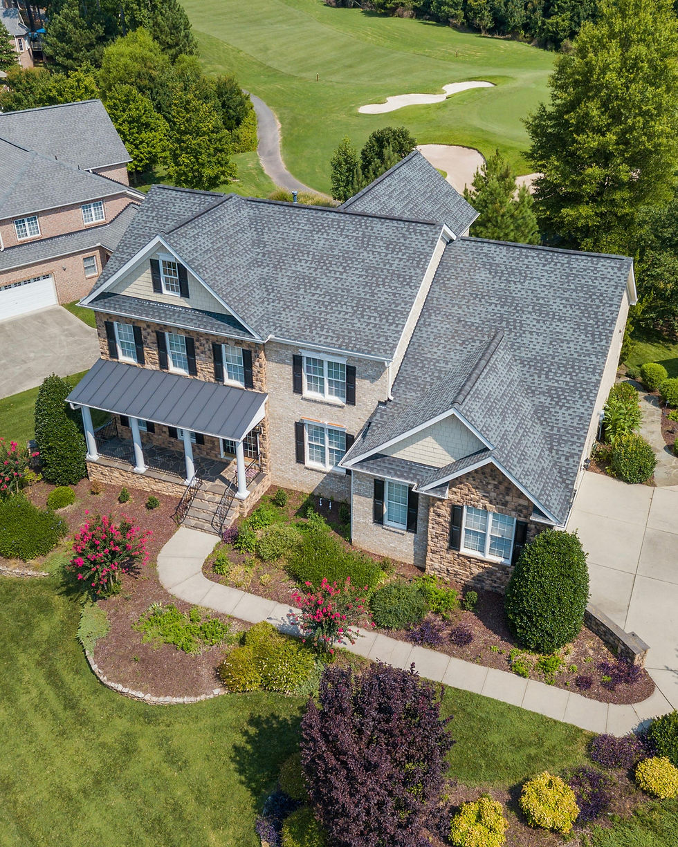
Aerial photography changes that equation completely. A drone at 100 to 200 feet doesn't just show a roof and a yard — it shows what the property sits inside of. That's a different kind of information, and it's the kind of information that determines whether a buyer has buyer's remorse or buyer's confidence.
This article catalogs 14 property conditions that aerial photography reveals — conditions that standard listing photos routinely conceal. We've also compiled available data on how each condition affects property value, time on market, and buyer satisfaction, making this a resource worth saving if you're an agent, buyer, investor, or land broker.
Why Standard Listing Photos Have a Built-In Blind Spot

The conventional real estate photo set was developed for a specific purpose: to make the property itself look attractive. Photographers are briefed to showcase the kitchen, the primary suite, the backyard entertaining area, the curb appeal. The camera points inward and upward. The neighborhood, the adjacent parcels, the infrastructure — these exist outside the frame.
That design served the industry well in an era when buyers toured properties in person before making decisions. The in-person tour filled in everything the photos left out. A buyer walking the property could see the power substation two lots over. They could notice that the north side of the lot dips into a drainage channel. They could hear traffic from the nearby commercial corridor.
But the in-person tour is no longer the first filter. According to the National Association of Realtors, 100% of today's home buyers begin their property search online. Research from Zillow indicates that buyers now view an average of 3 to 4 homes in person — down from many more in prior decades — because they make significant filtering decisions based on digital listings alone. The photos are no longer a preview. For many buyers, they're the decision.
When the photos don't show what surrounds the property, buyers make decisions based on incomplete information. The in-person showing reveals problems they should have seen earlier. And when a buyer's offer is already accepted — or worse, when they've already closed — those problems become very expensive discoveries.
The 14 Property Conditions Aerial Photography Reveals
The following table synthesizes data from NAR research, the Counselors of Real Estate, FEMA flood data, and property valuation studies to show how each condition affects a property — and what aerial photography can expose before a buyer is committed.
Property Condition | What Aerial Photography Reveals | Estimated Value Impact | Visible in Ground Photos? |
High-voltage power lines | Towers, line paths, proximity to structure, easement corridors | -10% to -30% | Rarely |
Flood-prone areas / drainage swales | Low-lying terrain, drainage channels, proximity to water bodies | Varies; uninsurable in some zones | Never |
Adjacent commercial / industrial use | Loading docks, dumpsters, truck staging, commercial rooftops | -5% to -15% | Never |
Cell towers / broadcast antennas | Tower location, sight lines from primary living areas | -2% to -9% | Rarely |
Railroad tracks or corridors | Track proximity, elevation of tracks, buffer distance | -7% to -20% | Sometimes |
Busy arterial roads | Traffic volume context, distance from travel lanes, noise buffer | -3% to -10% | Sometimes |
Sewage treatment / lift stations | Facility footprint, prevailing wind context, proximity | -2% to -5% | Never |
Gravel pits / quarry operations | Operational footprint, prevailing dust/noise direction | -5% to -12% | Never |
Adjacent lot development activity | Excavation, framing, commercial construction near boundary | Temporary but significant | Rarely |
Underground utility easements | Surface markings, cleared corridors, restricted build zones | Limits usable land | Never |
Gas stations / underground storage | Canopy, tanks, setback to property | Environmental risk premium | Sometimes |
Lot boundary clarity | True parcel shape, encroachments, fence vs. legal line | Litigation risk if missed | Never |
Wetlands / protected natural areas | Vegetation patterns, water table markers, buffer zones | Can eliminate development rights | Never |
Airport / flight path proximity | Flight path corridor, proximity to runway end | -3% to -15% | Never |
Sources: Counselors of Real Estate (power lines, -10% to -30%); NAR Flood Insurance Research; Orchard / FastExpert property value research; FEMA Flood Zone data; PropertyClub analysis.
Breaking Down the Most Consequential Conditions
1. High-Voltage Power Lines
Among all contextual conditions that affect residential real estate, high-voltage transmission lines produce the most consistently measurable value reduction. Research from the Counselors of Real Estate places the discount at 2% to 10% for properties adjacent to lines, rising to 10% to 30% or more for properties directly beneath transmission corridors or within 150 feet of towers.
The challenge from a listing photography standpoint is that power lines rarely appear in standard listing photos because photographers shoot to avoid them. A front-elevation shot is typically composed to exclude utility poles. A backyard photo is framed to avoid the fence line where transmission infrastructure becomes visible. The result: a buyer browsing the listing sees nothing. A buyer with access to a 150-foot aerial overview sees the transmission corridor running through the adjacent parcel immediately.
This matters especially in suburban markets where high-voltage distribution lines were built decades ago and neighborhoods have grown around them. Properties in these areas may sell at significant discounts — or fail to sell — while listing photos present a normal-looking home with no visible context for the price discrepancy.
2. Flood Zones and Drainage Topography
FEMA flood zone designation affects an estimated 15 million U.S. properties. The National Flood Insurance Program reports that even one inch of water damage in a home can cost over $25,000 to remediate. Yet flood zone status — and the topographic reality that puts a property at risk — is almost never visible in a standard listing photo set.
Aerial photography reveals the physical evidence. A low-lying rear lot area that collects drainage from adjacent properties. A drainage swale that runs along the property's western boundary. The elevation gradient that places the rear third of a lot below the grade of the street. These conditions are clearly visible from 100 to 200 feet altitude and are impossible to communicate with ground-level photography.
For agents, this matters from a disclosure perspective as well. Several states — including New Jersey, Florida, and Texas — now require disclosure of flood zone status and prior flood history. Providing aerial imagery that documents topographic reality is increasingly recognized as a component of thorough, defensible disclosure.
3. Adjacent Commercial and Industrial Use
One of the most common sources of buyer's remorse in residential transactions is discovering — after closing — that the property backs up to a commercial or industrial use that wasn't apparent from the listing photos. Loading docks for a distribution center. Dumpster areas behind a restaurant strip. An outdoor storage yard for a construction company.
These conditions reduce residential value by 5% to 15% depending on the intensity of the use and the proximity to the residence. They also directly affect buyer satisfaction and likelihood of resale. Buyers who discover adjacent commercial use after purchase frequently report feeling deceived by listing photos — even when no active deception occurred.
From 100 to 200 feet altitude, the commercial footprint of adjacent parcels is immediately apparent. A drone photo taken from the rear property boundary tells the complete story of what the backyard backs up to — a story that no amount of carefully composed ground-level photography can suppress.
How This Changes the Role of Aerial Photography
The traditional framing of drone photography in real estate is about selling the property: showing it at its best, from its most flattering angle, at the most compelling scale. That framing is correct as far as it goes. Aerial images do increase engagement — listings with aerial imagery receive 61% more online views and sell 68% faster than equivalent listings without aerial imagery, according to MLS research.
But the visibility gap argument adds a second, more durable value proposition. Aerial photography isn't just a marketing tool. It's a disclosure tool. It's an information instrument that allows buyers to make informed decisions and allows agents to demonstrate that they've provided complete contextual information about the properties they represent.
In an era where AI-powered search tools are increasingly surfacing property-specific information to buyers before they ever contact an agent — and where online reviews, disclosure lawsuits, and agent reputation are more consequential than ever — the aerial photo set that tells the complete story is worth far more than the aerial photo set that just makes the house look good.
What to Brief Your Photographer On
If you're an agent working with an aerial photography company, the visibility gap framework suggests a different set of briefing questions than the standard "show the pool and the backyard" conversation:
What's on the adjacent parcels, and at what altitude does it become clear?
Is there any infrastructure (power lines, cell towers, substations) within 500 feet that appears at altitude?
Does the lot topography suggest drainage or flood exposure that a buyer should see?
What is the commercial/industrial context within a quarter mile, and how does it appear from above?
Are there any boundary or easement features that aerial imagery can document?
APEX Drone Co includes a pre-flight property review as part of every engagement, identifying the contextual conditions present at each property so that aerial shots are composed to inform rather than simply to flatter.
For Buyers: How to Use Aerial Photography as a Due Diligence Tool
If you're purchasing a property and the listing doesn't include aerial imagery, you can request it. Some agents will commission drone photography during the due diligence period. Alternatively, satellite imagery tools — Google Earth, ESRI's ArcGIS, county GIS parcel viewers — can provide altitude context, though they lack the resolution and freshness of a professional drone shoot.
Before making an offer on any property, consider reviewing aerial imagery for: transmission infrastructure, lot boundary shape versus the fence line, adjacent land uses, topographic context, and proximity to roads and commercial corridors. These are the conditions that ground-level listing photos are least likely to show — and most likely to affect your ownership experience.
FAQs | Frequently Asked Questions
Does aerial photography always reveal these problems?
Aerial photography at the standard altitudes used for residential real estate (50–250 feet) effectively reveals most of the conditions listed above. Some subsurface issues — underground storage tanks, buried utility lines — require specialist investigation that aerial photography cannot replace. But surface and contextual conditions are reliably visible from altitude.
Are agents legally required to disclose these conditions?
Disclosure requirements vary by state and condition. Flood zone status and prior flood history now require disclosure in many states. Power line proximity is generally not required to be disclosed in most jurisdictions unless the listing agent has specific knowledge that it materially affects the property. However, the trend in real estate law is toward more disclosure, not less, and providing aerial imagery that documents surrounding conditions is broadly recognized as best practice.
Can aerial photography be used in a disclosure document?
Yes. Aerial images can be included in seller disclosure packages, due diligence reports, and transaction documentation to provide a visual record of the property's contextual conditions at the time of listing. This is particularly valuable for properties near flood zones, transmission infrastructure, or adjacent commercial uses.
Does APEX Drone Co offer contextual aerial photography specifically for disclosure purposes?
APEX Drone Co offers comprehensive aerial packages that include both marketing-oriented imagery (flattering angles, optimal lighting) and contextual documentation shots (adjacent parcel views, infrastructure context, boundary documentation). Contact us to discuss the right package for your property type.
Comments